copy 2")
Amdo Tibetan-speaking tribes played an essential role in the formation of several Chinese dynasties in the northeast; but during the Tang Dynasty, the Tibetan Empire of the Yarlung kings consolidated its control over the whole region of Far-east Tibet. Culturally, the peoples of the region have remained within the Tibetan orbit ever since, influenced by both the Bon and the Buddhist traditions. The unifying influence of Tibetan culture withstood the political fragmentation of the region which followed the collapse of the Yarlung Empire in the ninth century, and it was through contact with the Sakyapa and Kagyupa traditions in the grasslands that the Mongol tribes of Genghiz Qan and his successors were brought within the fold of Tibetan Buddhism.
For some 500 years (13th-18th century) the Mongol tribes dominated the grasslands. Following the conversion of Altan Qan to the Gelukpa school by Dalai Lama III in 1580, successive Qans zealously sought to impose the acceptance of the Gelukpa order upon the diverse cultural traditions of the region.
Gushi An of the Qosot Mongols established his kingdom around Lake Kokonor, and in 1641 aided Dalai Lama V in unifying spiritual and temporal power under his authority in Lhasa. His military campaigns directed against the Bonpo and Kagyupa monasteries of Kham, in particular, were extended into the Gyarong region during the 18th century by Changkya Qutuktu Rolpei Dorje, who targeted the Bonpo and Nyingmapa in particular. Despite these efforts, the traditions of the Bonpo, Nyingmapa, and Jonanga remain strong in Gyarong and neighboring areas at the present day.
Following the pacification of the Mongols by the Manchu emperor Qianlong in the 18th century, the political vacuum in the Amdo area was filled by the Muslims who encroached southwest from Xining toward Jegu dominating the trade routes.
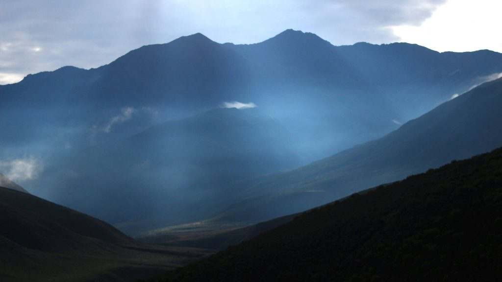
The southern border of Amdo is divided from the Salween basin of West Kham by the Dangla Mountains, and from the Yangzte and Y along basins of East Kham by the rolling Bayankala Mountains, which form a southeast spur of the Kunluns.
In the northwest, the Altyn Tagh range divides the Tsaidam basin of Northwest Amdo from present Xinjiang; and in the northeast, the jagged Choke Namgyel Mountains (Ch Qilian) divide the Kokonor basin of Northeast Amdo from the Gansu corridor and Mongolia.
In the extreme east, the Min, Longmen, and Qionglai mountains divide the Amdo grasslands and Gyarong gorges from the mainland Chinese parts of Sichuan and Gansu. Other ranges internally demarcate the distinct regions of Amdo and Grarong: The Kunlun range, which divides the Jangtang Lakes and Yangtze headwaters from the Tsaidam basin; the Amnye Machen range which forms the bend of the Yellow River, dividing the nomadic tribes of Golok (south) from those of Banak (north); the Nyenpo Yurtse range dividing Golok from Gyarong; and the Nanshan range, which divides Kokonor from the Yellow River basin.
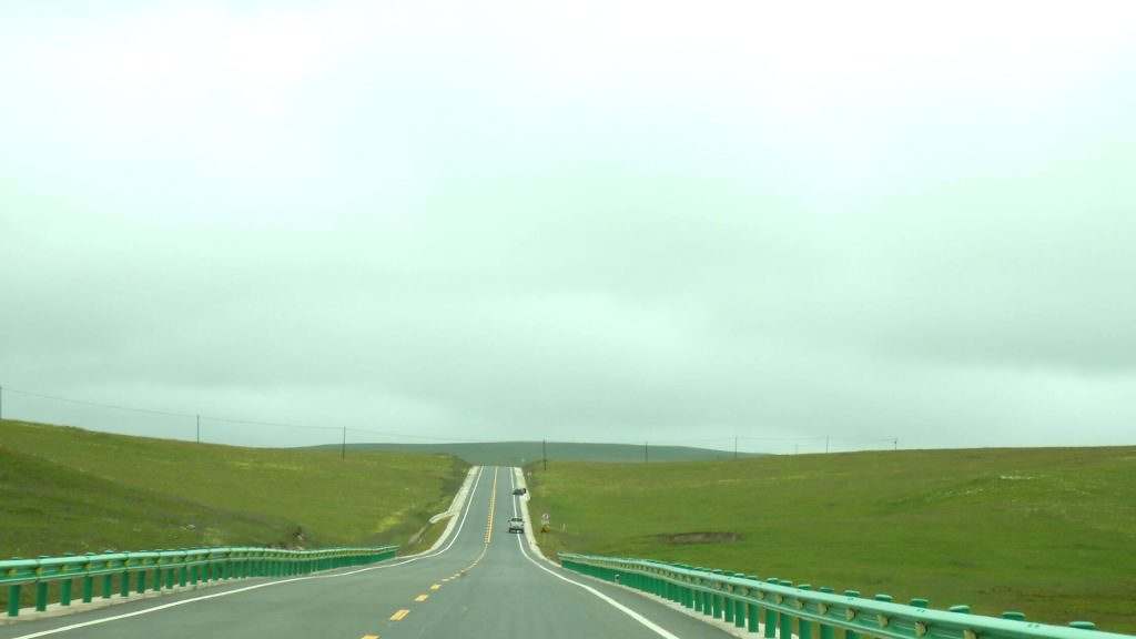
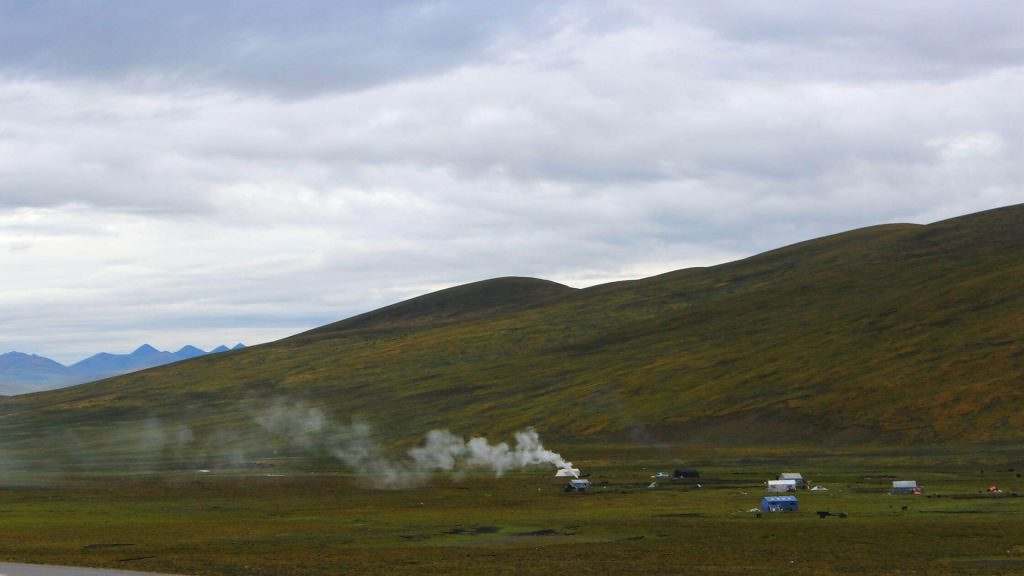
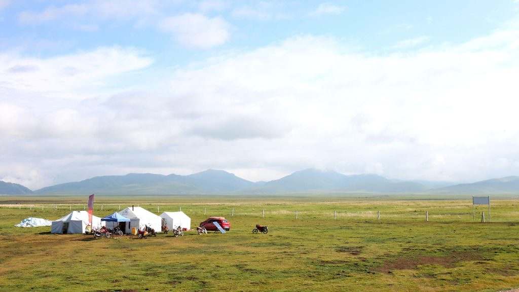
The terrain of Far-east Tibet is characterized by its broad valleys, rolling hills, and extensive flat tableland. However, there are considerable variations between the deserts of the Tsaidam and Jangtang, the rich grasslands of Amdo, and the forested gorges of Gyarong.
The north-westerly parts of the Tsaidam (2,700-3,000 meters) are characterized by denuded plains of bedrock; while in the lower southeast (2,600-2,700 meters) there are thick Meso-Cenozoic deposits. The terrain, therefore, varies between gravel, sand, and clay deserts, semi-desert tundra, and salt wastelands.
The Altyn Tagh Mountains, which divide the northwest border of the [saidam from the Tarim basin of East Turkestan, extend over 805 kilometers. the western hills are rugged and rocky, above 5,700 meters with perennial snow peaks and glaciers. The central part of the range is lower at 4,000 meters; but is higher in the northeast, at 5,000 meters. There are few rivers except in the southwest, and the central portion which adjoins the Tsaidam is arid and waterless.
The Chokle Namgyel (Qilian) range, dividing the Kokonor basin from the Gobi Desert of Mongolia, runs from northwest to southeast at an average altitude of 5,100 meters. Many rivers originate from its glaciated peaks, especially the Ruo Shui (known as Etzingol River in Mongolian) which flows northwards into Mongolia. Around 4,200 meters there is high-altitude Pastureland.
The Nanshan range, which divides the Kokonor basin from the Yellow River, has an average altitude of 4,000-5,000 meters; the higher western peaks are glaciated and exceed 6,000 meters. There are several intermontane tectonic depressions on both sides of the range, the largest being that of Lake Kokonor to the north. In the lower eastern parts of the range, where the intermontane valleys are more open, humid and warm rains penetrate. Tributaries of the Yellow River rise to the south of the range.
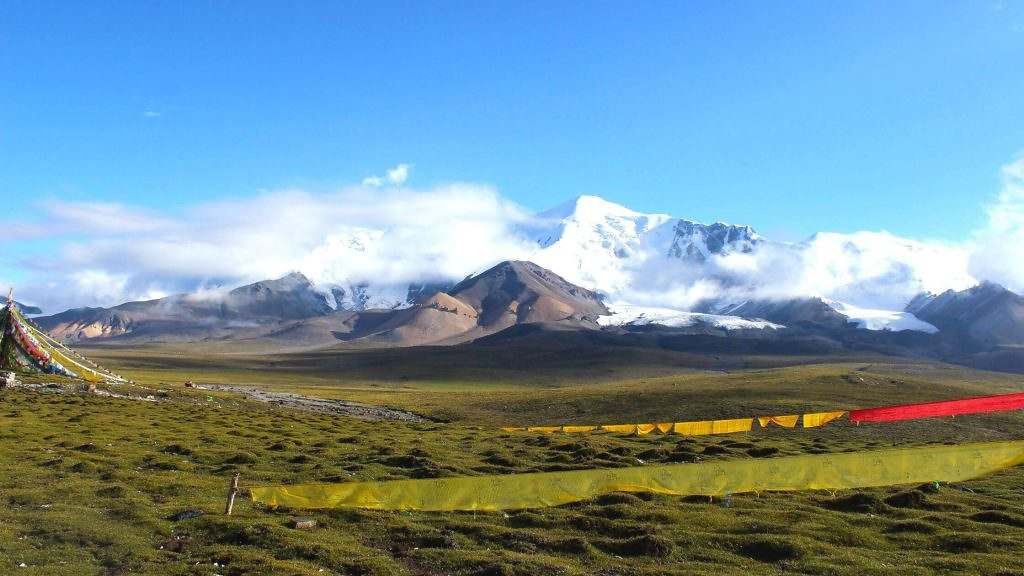
In the south, the Bayankala range divides Amdo from Kham. The northwest peaks of this range lie south of Kyareng and Ngoreng lakes, at an average altitude of 4,600-5, 100 meters; and they are the source of the Yellow River. The central hills of the range are rounded and rolling. The most renowned peak in the southeast is Mount Nyenpo Yurtse (5,369 m), the sacred mountain of the Golok, which is surrounded by five lakes.
The Amnye Machen range, which forms the bend of the Yellow River, extends from higher northwest peaks to lower southeast peaks. This range, which is revered as the sacred abode of the protector deity Machen Pomra, has 21 major snow peaks: the three main ones are situated towards the northwest end. Mount Dradul Lungshok (6,154 meters) is the northernmost peak; Mount Amnye Machen (6,282 m) is the central peak; and Mount Chenrezik (6,127 m) is the southernmost peak. The northern Golog foothills between the Bayankala and Amnyen Machen average 4,200 meters.
The Min Shan range, which demarcates the eastern extremity of the Amdo grasslands, forms the river basins of the Minjiang and Jialing, characterized by strata of red clay, red sandstone, and gypsum. This part of the plateau is exposed to higher precipitation levels, as much as 508 millimeters.
The Tibetan population of Amdo comprises the Drok-ke speaking nomads of Banak, Golok, and Ngawa; the Rong-ke speaking towns of the Tsong-chu valley, and the semi-Drok-ke (also called Rongma Drok-ke) speaking settlements of Repkong, Labrang, Luchu and Jo-ne areas. Non-Tibetan languages are also spoken within the Amdo area: particularly among the Salar Muslims of Dow County, the Tu of Gonlung and Pari counties, and the Mongols of Sogwo county. Further south, in the Gyarong gorges and the lower Min valley, there are Tibet-Burman populations of the ancient Qiangic speaking language group, including those who speak Tawu-ke (in Tawu and Rongtrak), Gyarong-ke (in Chuchen and Tsenlha), and Qiang-ke in Maowen.
The Qiang were forced into the mountain fastnesses of the Gyarong and Min valleys by the Qin and Han Emperors following their unification of China in the pre-Christian era. Their Qiang Long stone culture is characterized by the construction of large stone watchtowers and sturdy stone dwellings, often containing white quartz rocks which were regarded as sacred artifacts.
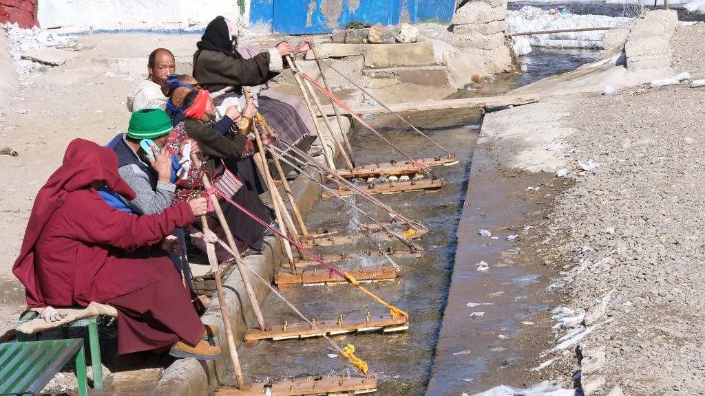
The rich pastures of the Amdo grasslands sustain a nomadic population larger than in any other part of Tibet. These nomads, including the Machen county and the Banak (north of Amnye Machen), have recently benefited economically from the reforms in China, but face a long-term threat to their future from environmental deterioration. The education system is basic at best, with Tibetans forced to study Chinese if they wish to advance in their chosen career.
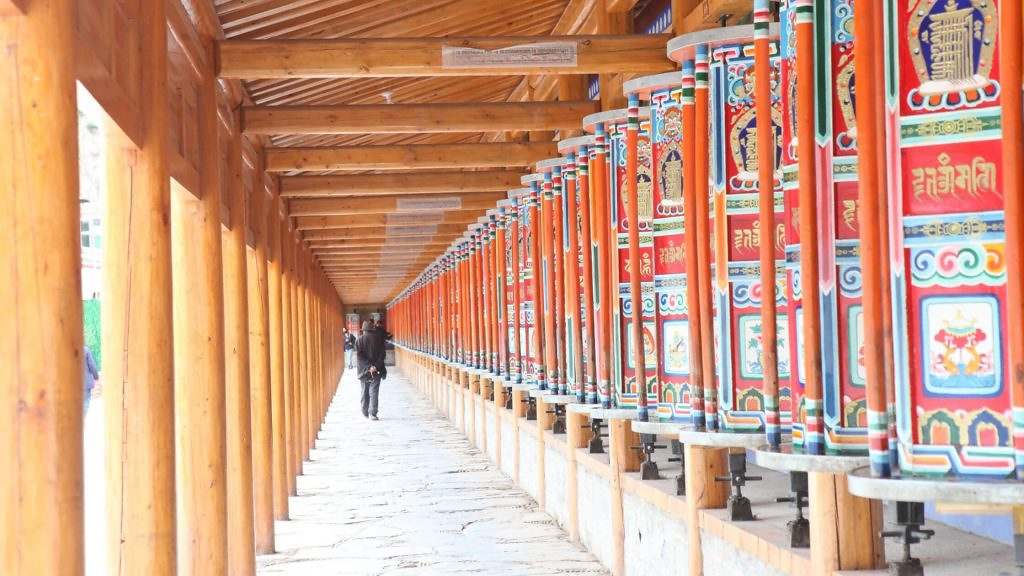
There are few employment opportunities in this region, so most children follow their parents and become nomadic pastoralists, while a few, mostly boys, join one of the numerous monasteries that have been rebuilt in the last 13 years. Government funds have been allotted to help rebuild these monasteries, and each site is given a quota of timber and building materials, as well as a construction team, usually composed of Chinese craftsmen. This official help however covers little more than the basic building, and the Tibetans are forced to look to the local communities for the cost of internal and external decoration, and the construction of monastic residences.
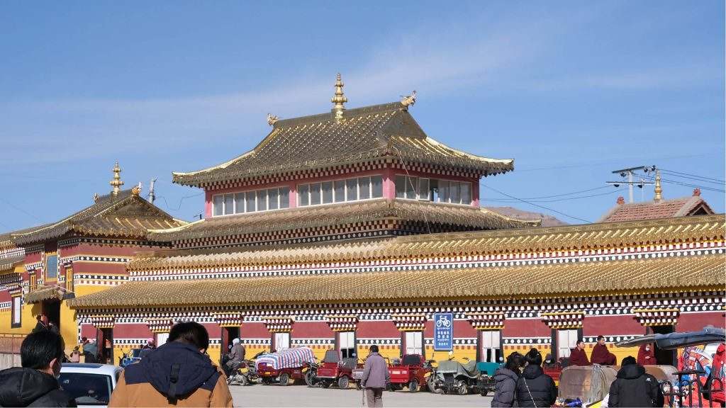
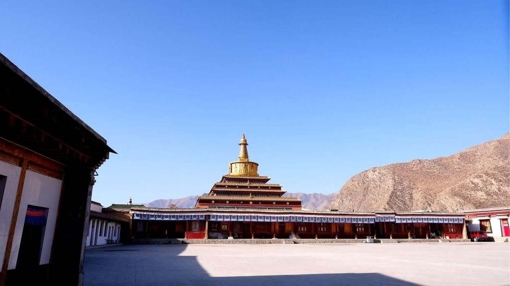
As a result, most of these monasteries are little more than concrete sheds, only the timber entrance and porch roof supports being made in traditional style. Shrines, statues, and murals are generally very poorly executed, although there is now a small body of well-trained artists, centered at the excellent Schools of Painting in Repkong. Except for the main temples in Repkong, Labrang, and Kumbum, virtually all the original monasteries of Amdo were destroyed in the 1940s, and the vast bulk of Amdo’s artistic heritage has been lost.